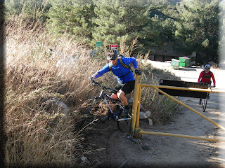
We began with an immediate climb toward Josephine Saddle. Steep and switchbacked (arrows point the way), soon we were looking out over Pasadena toward the city of LA, barely visible in the one pic (see arrow). Say hi to Buddy Steve and Stan the Man.


2.4 miles later and 1400' higher, we hit Josephine saddle. We talked to two ladies and one gentlemen who were running the same route we were on. One lady had a Western States 100 t-shirt on. They all were veterans of that race and the Badwater run, etc. In fact, one ladies husband had been the second place finisher in the Western States run. Impressive. I hate running, but I do envy the simplicity of trail travel by foot. Two shoes, a water bottle, some clothes. Go run.
The trail begins with some real hazardous sections. I used to ride this, but no more. A good friend pitched over the side and fell 10' into the canyon only to be stopped by a bush before he continued to a sheer 50' fall to almost certain death. He found out that bar ends, a rock outcropping on a narrow trail, and clipless pedals can be a bad combo. He was just a bit bloodied and was very fortunate.
The trail gets funner from here...is funner a word? More funner. How's that? Recent rains had provided perfect ground conditions and the weather had rebounded to make for sunny temps in the 60s and 70s. Gotta love So Cal. At 4 miles and 1700' of up-ness, we topped out to summit number one and the trail plunged down toward the backside of Strawberry Peak.

The fun is soon over after a sweet section of curvy, mildly techy canyon bottom singletrack. The fun ends because the trail turns up. And up. And up. Pushing going on here. Then riding. It is only 1000' in 2 miles, but some of that is in the first couple hundred yards and is ugly stuff.
At the next saddle, reached at 7.5 miles, Stan the Man let us know how he felt about the whole thing.


The trail drops down quite quickly to Hwy 2 at Red Box (named for a red box that used to sit in the parking lot...no kidding, really!) and the beginning of an excellent section of the Gabrielino trail. This is some choice singletrack, even though much of it is on an old roadbed and is quite wide, it still rocks. It is also rocky in the real sense and here the 29er wheels figuratively rock....er, on the rocks. Got that?
The trail is so sublime. Very little pedaling required, just enough brakes to keep things mellow and watch for trail users. It swoops and follows along the canyon through tunnels of oak and alder as the creek burbles in the streambed below.
A couple of miles of downhill, nearly perfectly sloped trail later, we arrived at Switzers picnic area. A ridiculously steep paved climb out of the canyon brought us back to Hwy 2 and then our truck. 3 hours and 14.5 miles later.


.jpg)


